CIPCast Platform

Critical Infrastructure Protection risk analysis and foreCAST

CIPCast is a geospatial (GIS-based) DSS that allows to perform risk analysis and forecast of a system of Critical Infrastructures (CI) also accounting for dependency effects.

CIPCast-OP: Operational platform


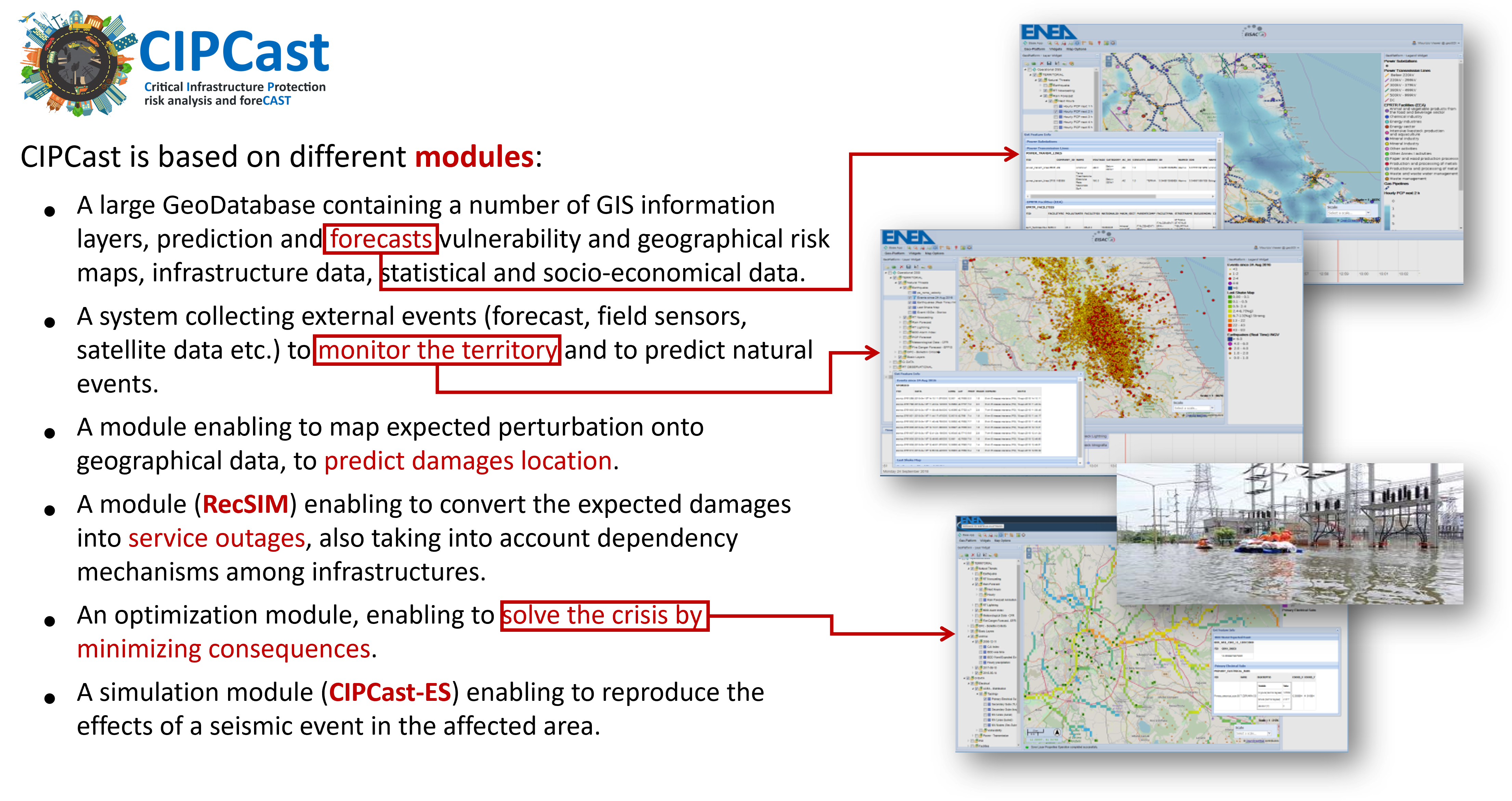
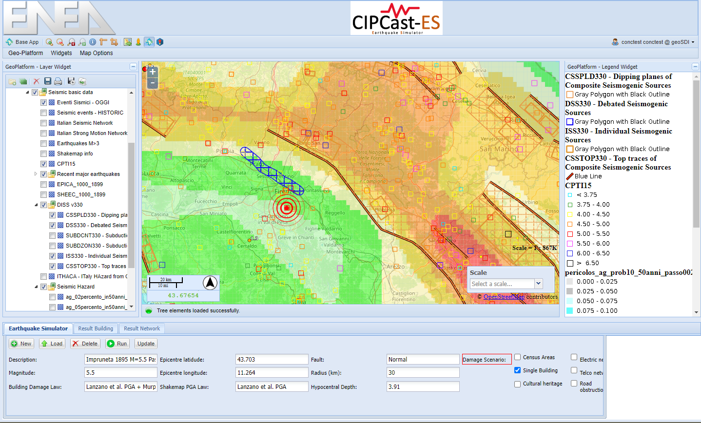
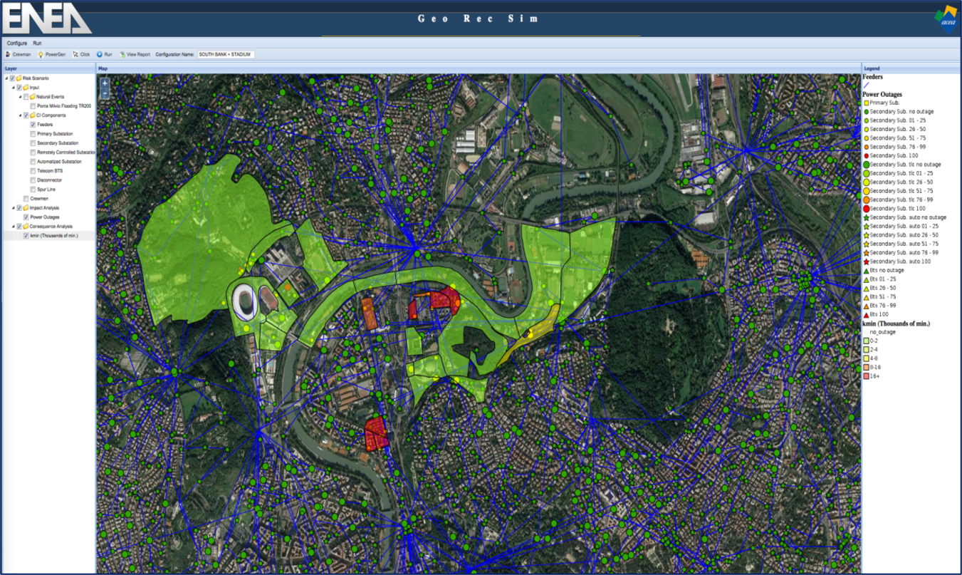
CIPCast-OP facilitates 24/7 operational risk analysis by integrating hazard maps, weather forecasts, sensor data, and geospatial information concerning infrastructures and the built environment. It supports the production of event scenarios by combining hazard assessment with CI exposure and specific vulnerability to critical events, thereby estimating induced damages and impacts.

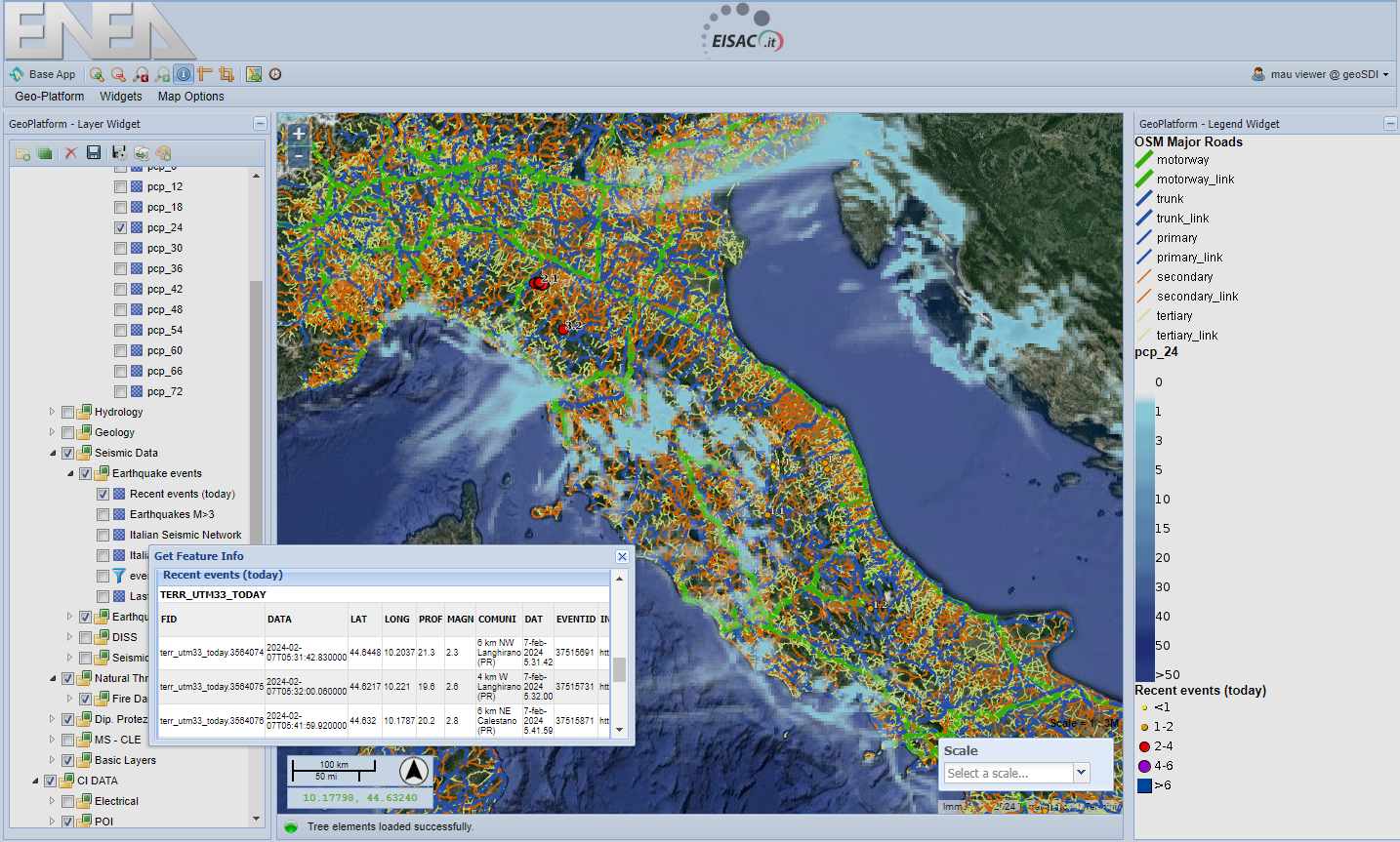
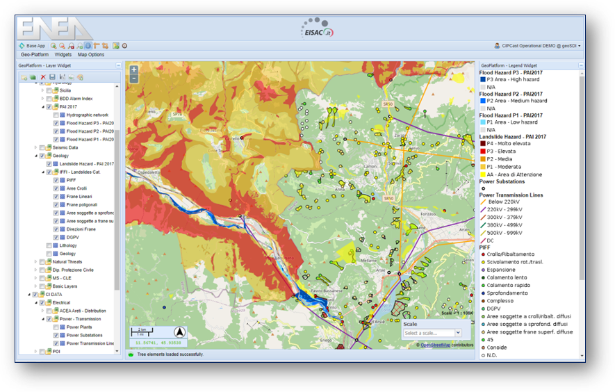
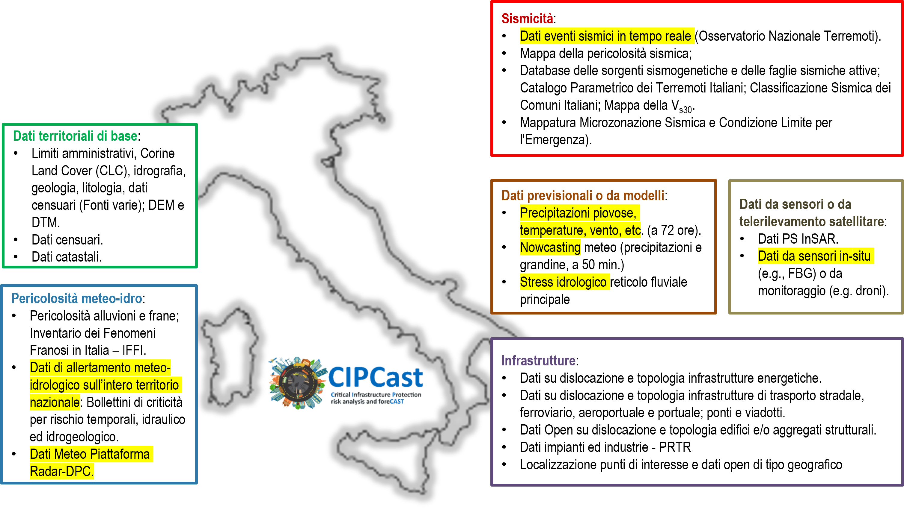
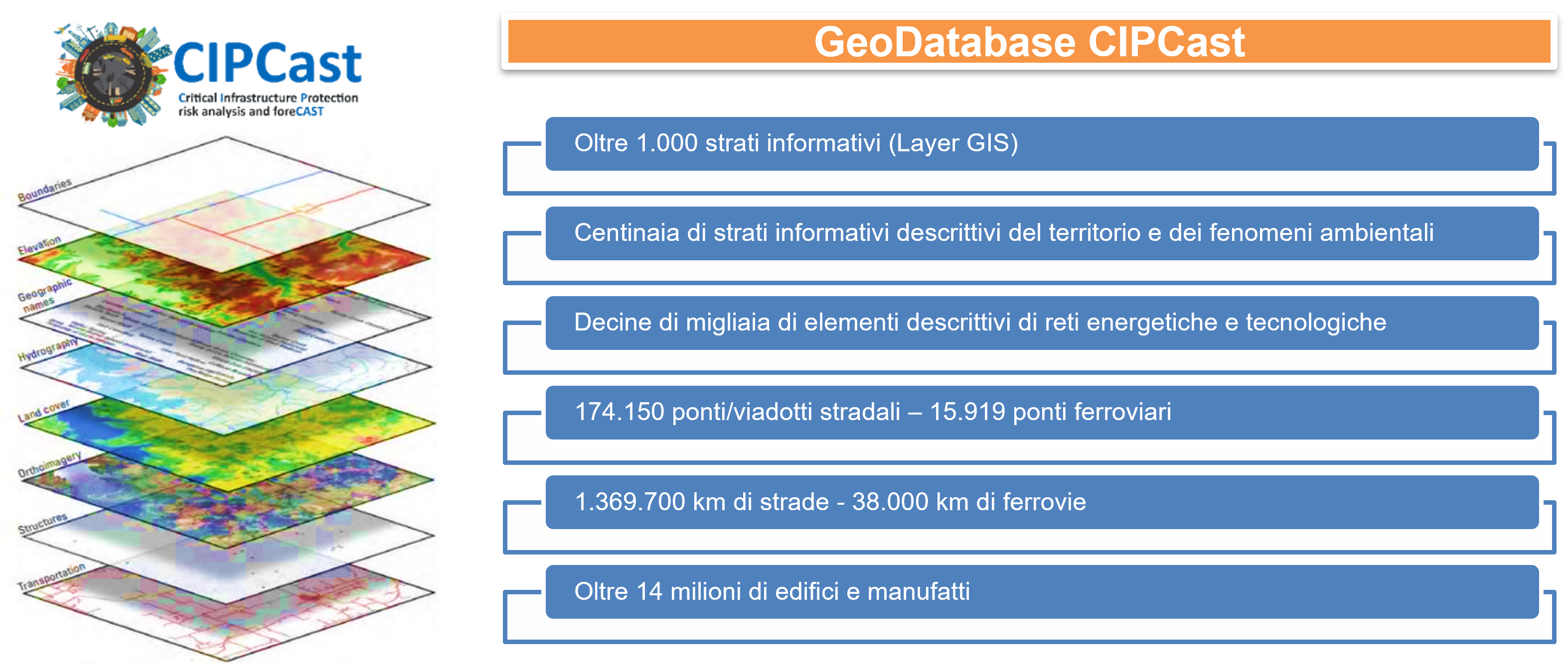
The platform relies on a comprehensive database comprising information layers sourced from various outlets, including open data and private sources. These layers encompass both slowly varying data (territorial, geophysical, census, structural/infrastructure data) and rapidly changing data (weather forecasts and nowcasts, meteo-hydrological criticality, seismic events, and data from field sensors or satellite image processing). CIPCast houses nearly 1000 information layers stored on a Postgres/PostGIS database, accessible through a user-friendly WebGIS interface.

CIPCast supports risk estimations by mapping hazards (as slowly varying data) and threat drivers (as rapidly varying data) within the geographic area hosting critical infrastructures. This enables dynamic risk analysis, alerting operators and public authorities responsible for infrastructure integrity and functionality to current conditions warranting attention. Initially, CIPCast generates a damage scenario, identifying infrastructure elements with a probability exceeding a threshold of being damaged by predicted events.

Furthermore, CIPCast is designed to consider infrastructure dependencies and evaluate the flow of disruptions from one infrastructure to another. By analyzing interdependency dynamics, the platform can identify potential cascading effects. These predictions leverage knowledge of interconnection points, where infrastructures exchange services, whenever such information is available.

Link to CIPcast Operational Application:
CIPCast-OP

CIPCast-DB CIPCast-DB


CIPCast-ES: Earthquake Simulator


CIPCast-ES assesses earthquake-induced damages and impacts in both natural and built environments. The platform simulates ground shaking resulting from an earthquake event, providing estimates of potential damages to buildings and CI components, along with the resulting functional impacts such as power and water outages, road blockages, and more.

Users can utilize CIPCast-ES to simulate seismic events that have occurred, with the option to define event characteristics directly or select from historical database events and seismogenetic fault information available within the CIPCast-ES Application. In 'what-if' mode, CIPCast-ES aids in effective emergency and contingency planning, as well as in defining risk mitigation policies.

Furthermore, CIPCast-ES can be deployed post-event to provide an initial estimate of the scope and severity of induced damages and impacts. This estimated scenario can then be continually updated with sensor and crowd-sourced data, evolving into a reliable representation of potential damages and impacts. This information informs and supports the allocation and prioritization of available resources for a swift and effective response.

Link to CIPcast-ES Application:
CIPCast-ES

CIPCast-OP


RecSIM


RecSIM facilitates the assessment of potential functional impacts on urban electrical distribution systems, taking into account their possible dependencies on other critical infrastructures such as telecommunication and road networks.

RecSIM models the expected dynamics of a service outage following disruptions to components of the electrical network, as well as the actions taken at the control room level to restore service. The platform analyzes all possible control room actions to determine the optimal strategy for system restoration, with a focus on minimizing consequences for citizens and other end-users.

RecSIM can be integrated within CIPCast or used as a standalone application. It enables the estimation of impacts resulting from user-defined scenarios, whether they arise from natural or human-induced crises events.

RecSIM


CIPCast Geodatabase


CIPCast-DB is the GeoDatabase on which rely the CIPCast platform. It allows the management and storing of large quantities of geospatial data, coming from GIS processing or from external sources (e.g., Open Data, field sensor data, third party or distributed repositories, etc.).

The data are stored locally or in different remote servers, accessible through services compliant with the Open Geospatial Consortium (OGC) standards, namely, Web Feature Service (WFS), Web Coverage Service (WCS), and Web Map Service (WMS).

CIPCast-DB1 CIPCast-DB2